top of page



1
Aerial Mapping & Imaging
Professional-grade orthomosaics and 3D modeling for job site progress, as well as crop analysis.

2
Event Aerials
Stunning high-resolution photography and video for large-scale outdoor events.

3
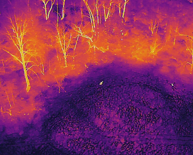
Thermal Deer Recovery
Using advanced thermal technology to locate downed game in the field. Photos taken after dark from approximately 400 ft away.

4
Thermal Imaging
Identify heat loss, moisture intrusion, and electrical faults with thermal imaging for residential and commercial assets.

5
Site & Property Photos
Premium aerial marketing photography capturing the scale and beauty of your land, home, or business site from unique perspectives.
Get in Touch
Need custom aerial work? Just shoot me an email directly for the quickest response time.
bottom of page